The Lachine Canal and its Industrial Corridor
par Desjardins, Pauline
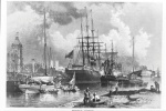
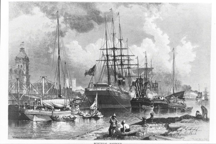
The corridor formed by the Lachine Canal and the surrounding area was recognized as a National Historic Site of Canada in 1996. The canal, which opened in 1825, allowed for the navigation of the tumultuous waters of the upper Saint Lawrence River, and played a major role in the development of the western part of the country. Its strategic position between the eastern and western portions of the Saint Lawrence led to the most diversified concentration of industrial establishments in the country. These factors also favored development of the Port of Montréal, making the city Canada’s first metropolis.
Article disponible en français : Canal de Lachine et son corridor industriel
A historic canal
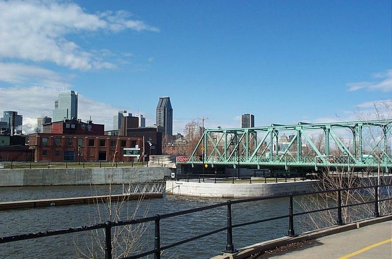
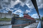
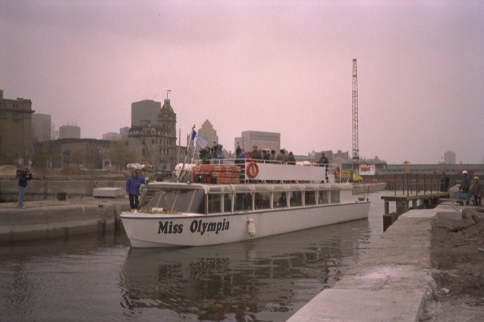
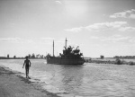
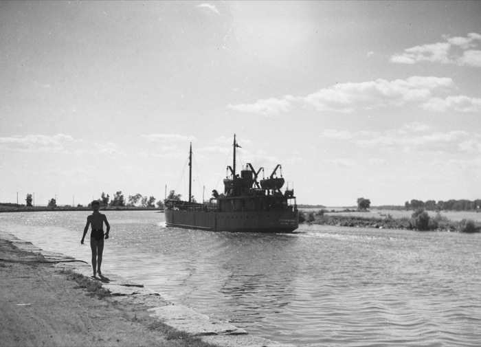
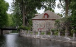
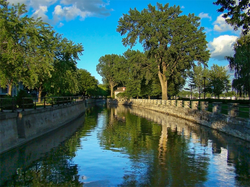
Today the Lachine Canal, operated by Parks Canada, allows pleasure craft to navigate the 14 km stretch from the Saint Lawrence to Lake Saint-Louis. Five locks act as lifts to overcome differences in levels in the canal ranging from 12 to 15 meters, depending on the season. The change in role from a commercially navigable waterway to one open for pleasure boating, does not affect the canal’s two principal characteristics. Historically, the canal first served as a catalyst for industrialization of the area, and then as a stabilizing force for an urban blue-collar population. Today the canal no longer attracts industry, but it is a draw for increasing tourist activity and a new population looking for a unique living environment.
A National Historic Site of Canada

Throughout its history, the Lachine Canal has caused almost as much ink to flow as it has water. From the reports recommending its construction, its subsequent transformations and the decisions surrounding its closing, to the studies calling for its conservation and reuse, the canal has been a subject of much discussion. In 1924 it was recognized for its national significance and was declared a National Historic Site of Canada in 1996, because of its value as a visible and tangible testament to the industrial history of Canada. The canal itself is imbued with educational potential likely to interest a great number of people in this field of Canadian history.
These witnesses of the industrial era make up what is called industrial heritage. This heritage includes all aspects of economic and social history as well as the more concrete aspects such as buildings, industrial complexes, facilities and sites. Industrial heritage includes not only buildings, but also technology, manufacturing processes (machines, raw materials, finished products, transmission of energy, etc.), workers, management, and landscape. A precise knowledge of technical processes, from the organization of labor to the development of buildings and of land, brings out the value and unique character of industrial heritage. Built heritage, with its context and industrial sites, allows for a better knowledge of a more or less recent past, as well as the transmission of knowledge that contributed to the creation of our present knowledge but is itself all but lost.
Transformation of a landscape
From the beginning of its construction in 1821, the canal served as anchor for a gradual transformation of landscape and habitat. Its initial lines were drawn in the middle of a rural area on the periphery of the city and surrounding towns. From the time of its construction, workers settled on the banks, forming new centres of population. Other industries, such as shipbuilding and warehousing, came to take advantage of the waterway. Gradually other industries joined these first ones, primarily around the locks, so as to benefit from the waterpower provided by these quasi-dams. Workers settled near the factories, enhancing the population centres, some of which became new municipalities. The landscape changed along with the process of urbanization, until hardly any of the space around the canal remained unoccupied.
A waterway at the head of a canal system

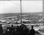
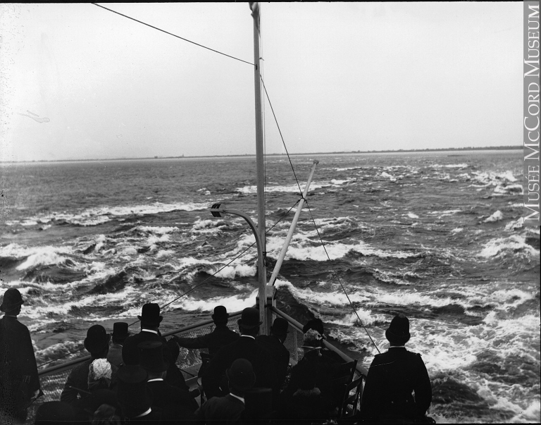
The need for of a canal to bypass the Lachine rapids (formerly Sault Saint Louis) was a major concern since the beginning of European colonization. In 1680, the Sulpicians, seigneurs of the island of Montréal, had planned to build a canal between Ville-Marie and Lachine connecting the various watercourses in the region. The canal, which would have been the first in North America, was never completed, although several large sections were dug. It was more than a century later that a navigable waterway would join Montréal and Lachine.
Construction of the Saint Lawrence canal system, of which the Lachine Canal is a part, was initiated by the British to facilitate transport of troops and supplies to the Great Lakes. This military action was necessary to protect the border of the Province of Canada from American invasion during the War of Independence (1775-1783) and then again during the War of 1812-1814. The majority of the canals were built to divert shipping so as to avoid the change in elevation that formed rapids and waterfalls, numerous in the Upper Saint Lawrence.

Situated at the head of the canal system, the Lachine Canal is the first work not to have been built by military troops. It was the merchants of Montréal who created the necessary pressure for construction of the canal and for legislation aimed at completing it. Most of these businessmen, more and more numerous in the early 19th century, came from Great Britain, which was in the midst of an industrial revolution. The merchants were very aware of the importance of canals as a means of transportation, since Great Britain was experiencing a “canal mania” in the years between 1760-1840. However, the merchants of Montréal did not succeed in raising the private capital necessary, and the government of Lower Canada had to take over the greater part of the financing. The engineer responsible for this work was a British man, Thomas Burnett (17??-1824).
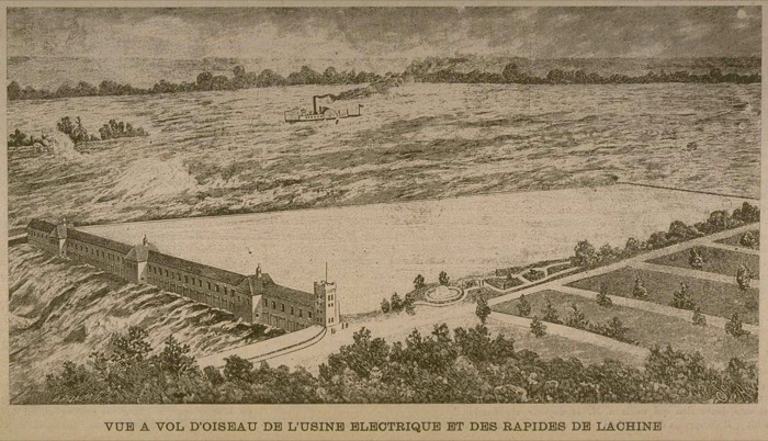
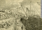
The Saint Lawrence canal system, joining Montréal to Lake Ontario, underwent four main phases of development during which the Lachine, (the old) Beauharnois, Cornwall, Williamsburg and Soulanges canals were built. Planning of the Lachine Canal took place during the first phase, between 1815 and 1821, and the canal was built between the years 1821 and 1825. The second phase was marked by an enlargement and significant redevelopment of the canal, which between 1843 and 1849 was nearly doubled in width and depth, and a second set of locks was built parallel to the first. At this time the development of hydraulic lots was planned, based on the model of Lowell, Massachusetts, which made available hydraulic energy to encourage industrial development.
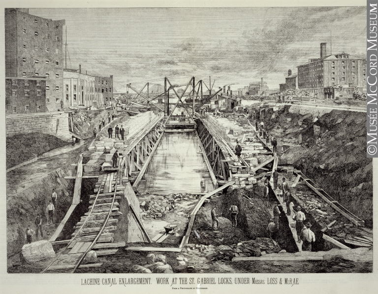
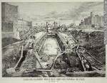
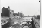
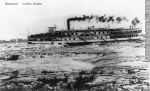
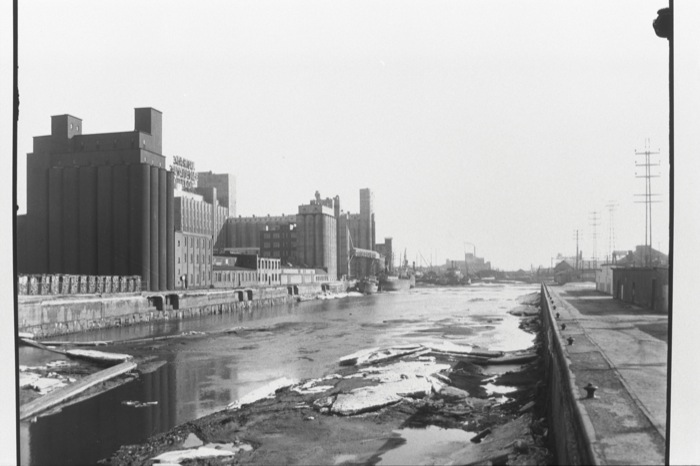
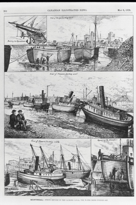
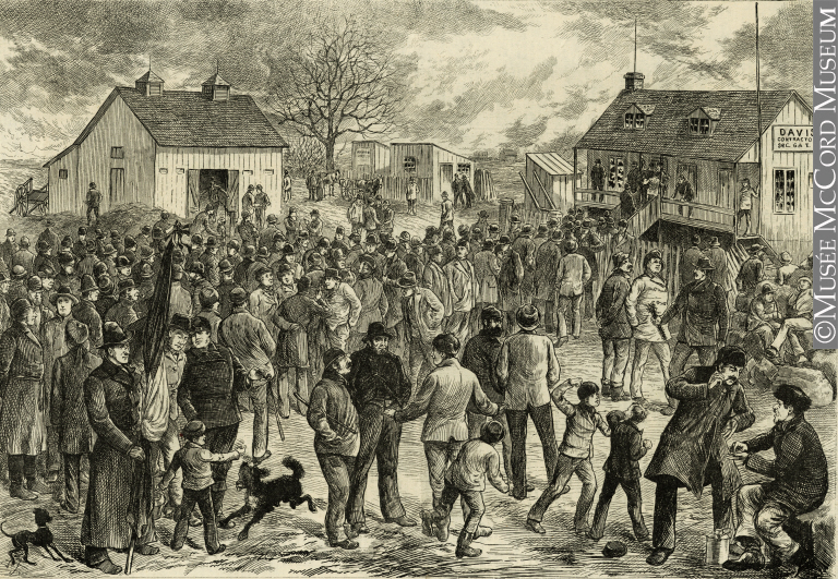
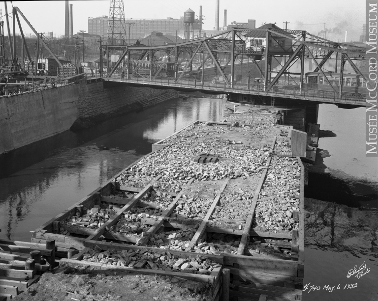
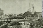
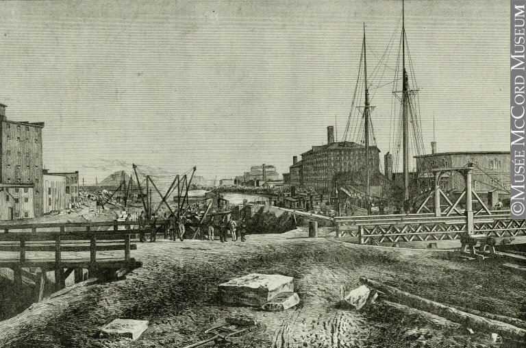
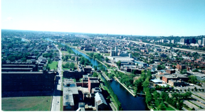
The third phase in development of the Saint Lawrence canals began with a new transformation of the Lachine Canal, whose original locks were replaced with newer and larger ones between 1873 and 1885. This opened the waterway to larger ships and allowed for a significant increase in maritime traffic. The adjoining areas also became more industrialized and urbanized. Nearly 600 industrial firms were established in the Lachine Canal corridor between 1840 and 1950, employing nearly a quarter of all the artisans and factory workers of Montréal's manufacturing sector. In 1959, following the opening of the present-day Saint Lawrence Seaway, the authorities gradually abandoned the Lachine Canal and the other Saint Lawrence canals. The Lachine Canal was closed to all navigation in 1970. This final phase brought about enormous changes to Montréal industry, and a dispersion of production centres as the road system and trucking industry developed.
From industry to tourism
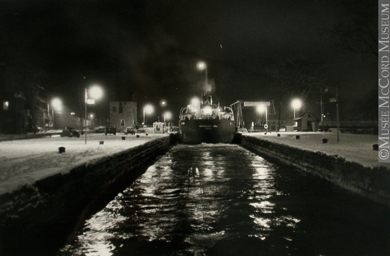
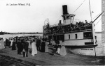
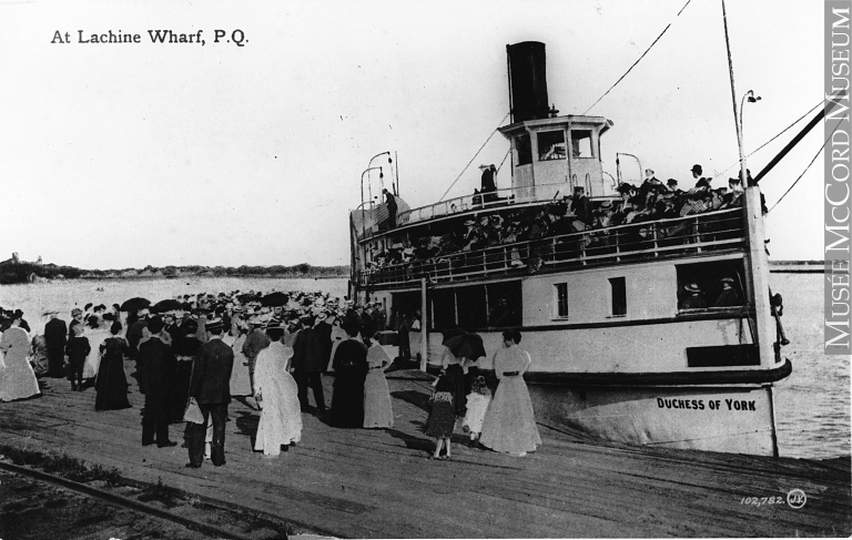
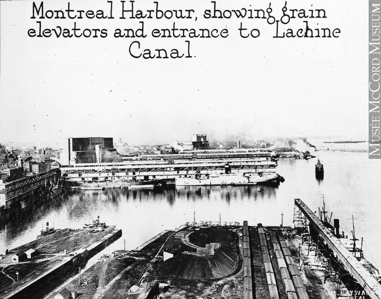
The Lachine Canal was open for navigation for nearly 150 years (1825-1970). Closed to commercial navigation in 1970, it was reopened to pleasure boating in 2002. In the meantime, it was the focus of various development projects. The first renovation was carried by Ministry of Public Works (Canada), which developed a bicycle path as part of the ACTION 77 program for urban recreational parks. Parks Canada took over part of the canal in 1978, making possible a large number of historical studies on canals, the history of canals in Canada and in Québec, the physical structures of the Lachine Canal, industrialization and urbanization. The lower section of the canal, overlooking the Old Port of Montréal, had been entirely filled in between 1965 and 1967. When it came under the authority of the Old Port of Montréal Corporation, this section was cleared and developed as a city park between 1990 and 1992. This time its maritime purposes were retained. A series of locks (locks 1 and 2 north) were restored to working condition, and the first boat in 30 years passed through.
In 1996 the Historic Sites and Monuments Board of Canada (HSMBC) recognized the Lachine Canal corridor as a National Historic Site of Canada, underlining the national significance of the canal as a navigable waterway since 1924. This designation was awarded on the basis of three aspects of national historical significance, as mentioned in the commemoration announcement:
1) “The Lachine Canal National Historic Site of Canada commemorates the role of the Lachine Canal in the 19th and 20th centuries as the port of entry for the system of canals linking the Atlantic Ocean to the heart of the continent via the Great Lakes and the Saint Lawrence River.
2) “The Lachine Canal was the forerunner of the transportation revolution in Canada in the early 19th century, and recalls the first attempts at canal-building undertaken during the French Régime. It thus played a decisive role in the industrial and commercial development of Montréal, notably as a supplier of hydraulic power.
3) “The Lachine Canal industrial corridor bears witness to the various phases of Canada's industrialization and the exceptional diversity of industrial manufacturing that took place along its banks. It is a reminder that the area was one of Canada's main manufacturing centres from the beginning of industrialization in the middle of the 19th century until World War II.”
The rest of the canal from the Old Port of Montréal to Lachine was restored by Parks Canada between 2000 and 2002; as a result, today the canal is navigable in its entirety.
Since the canal was reopened for boating, first at locks 1 and 2 located at the Old Port of Montréal in 1992, then from locks 3 through 5 in 2002, the face of the corridor is ever changing. Parks Canada has organized many activities that allow for the exploration of the canal’s historical significance as well as its significance in the present day.
The future of the Lachine Canal

Recognition of the Lachine Canal as a National Historic Site of Canada was intended to protect its distinct character and draw attention to the industrial history of the corridor. However, despite the efforts made by federal institutions and by the City of Montréal, this former centre of the manufacturing industry now faces a wave of development that threatens its remaining industrial functions and endangers the preservation of important relics that contribute to interpretation and understanding of the historic site. More efforts are needed to make known and especially to protect this important Canadian industrial heritage.
Pauline Desjardins, Ph.D.
Additional DocumentsSome documents require an additional plugin to be consulted
Images
-
 Agrandissement du can
al de Lachine: ... -
 Au quai de Lachine, e
nvirons de Mont... -
 Baigneuses sur les be
rges du canal L... -
 Bateau «Daniel McAlli
ster» amarré au...

-
 Big John et son group
e descendant le... -
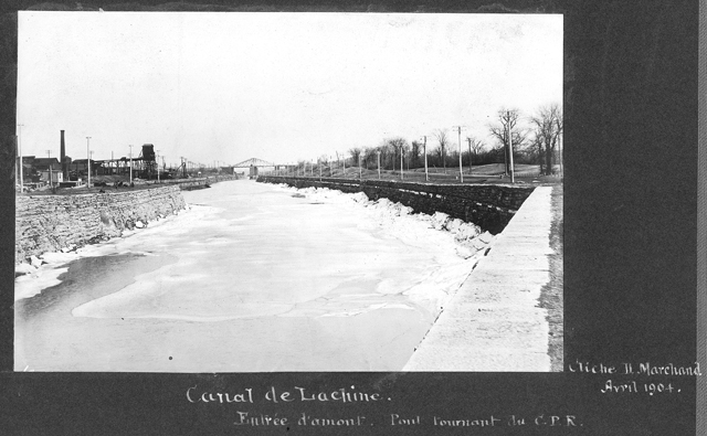
 Canal de Lachine. Ent
rée d'amont. Po... -
 Canal Lachine, 2005
-
 Canal Lachine, 2007


-
 Canal Lachine, Montré
al -
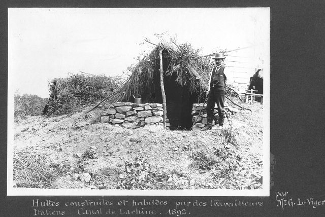
 Huttes construites et
habitées par d... -
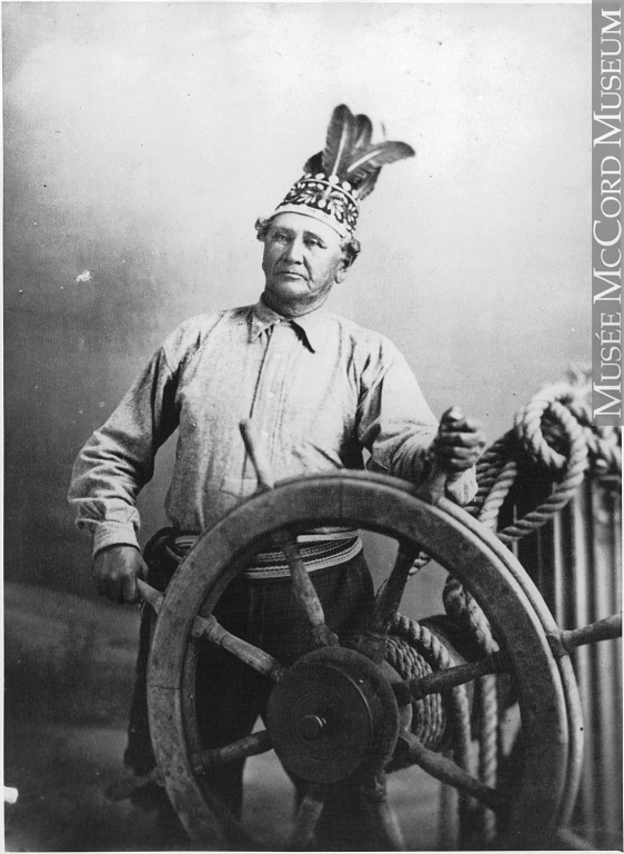
 Jean Baptiste Rice, p
ilote fluvial, ... -
 La réouverture des éc
luses de Montré...
-
 Lachine, 1909
-
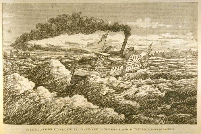
 Le bateau à vapeur «
Filgate», avec ... -
 Le canal Lachine, ver
s 1850 -
 Le navire «City of Be
lleville» franc...
-
 Le navire de charge «
Northcliffe Hal... -
 Le transbordement des
marchandises s... -
 Le vapeur «Prescott»,
rapides de Lac... -
 Le vapeur «Rapids Kin
g» franchissant...


-
 Le vapeur «Sovereign»
dans les rapid... -
 Les industries implan
tées sur les ri... -
 Les nouveaux travaux
sur le canal de... -
 Les rapides de Lachin
e, environs de ...


-
 Les travaux de radoub
et l’entreposa... -
 Montréal - Grève de
s ouvriers du c... -
 Pont tournant, canal
de Lachine, Mon... -
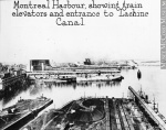 Port, élévateurs à
grains et entr...
-
 Poste de traite au bo
rd du canal Lac... -
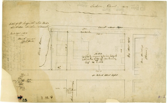
 Sketch of W. Redpath
Lot No 563 Sout... -
 TestIxmedia
-
 Travaux d'agrandissem
ent du Canal de...

Vidéo
Catégories
Bibliographie
Desjardins, Pauline, « Navigation and Waterpower : Adaptation and Technology on Canadian Canals », IA, The Journal of the Society for Industrial Archeology [en ligne], vol. 29, no 1, 2003, http://www.historycooperative.org/journals/sia/29.1/desjardins.html, consulté le 18 novembre 2009.
Desjardins, Pauline, L'organisation spatiale du corridor du canal de Lachine au XIXe siècle, Québec, Association des archéologues du Québec, 2006, 235 p.
Desloges, Yvon, et Alain Gelly, Le canal de Lachine : du tumulte des flots à l'essor industriel et urbain, 1860-1950, Sillery (Qc), Septentrion, 2002, 216 p.
« Dossier : Un patrimoine du progrès », Continuité, no 96, printemps 2003, p. 20-49.
La glace surprend les navires [en ligne], narration de Gaétan Montreuil, Montréal, Office national du film du Canada, 1959, http://onf-nfb.gc.ca/fra/collection/film/?id=2574.
Parcs Canada, Énoncé d'intégrité commémorative : lieu historique national du Canal-de-Lachine, Montréal, Parcs Canada, Unité de gestion de Montréal, 1997, 62 p. + fig.
Parcs Canada, « Lieu historique national du Canal-de-Lachine », Lieux historiques nationaux du Canada [en ligne], http://www.pc.gc.ca/fra/lhn-nhs/qc/canallachine/index.aspx.