Parc national d’Oka, a natural heritage site
par Piédalue, Gilles
Article disponible en français : Parc national d’Oka, un patrimoine naturel
A rich natural and cultural heritage (NOTE 1)
What is now Parc national d’Oka was part of the Lac des Deux Montagnes seigneurie, which was granted to the Sulpician order in 1717. By a combination of circumstances, the greater part of this territory remained in the hands of its first owners until the park was created. The Sulpicians reserved this land for their own needs (hunting, forestry, farming). The stock market crash of 1929 and the construction of the Université de Montréal during the Depression pushed the Sulpicians to the brink of bankruptcy. They sold part of their land, including the Oka Calvaire Hill (NOTE 2). In 1939 and 1942, the Sulpicians also gave, as security for a loan from the government of Quebec, land including some along the shore at Oka Beach (NOTE 3). This loan was settled in 1962 when the government of Quebec acquired the beach area, equivalent to 1.6 square kilometres. This land was called Réserve de chasse et de pêche de Deux-Montagnes, then renamed Parc provincial d'Oka the following year. In 1968 it was given the name Parc Paul-Sauvé, in honour of the deputy from the county of Deux-Montagnes who was premier of Quebec in 1959-1960.
Finally in 2001 the land was classified as a Quebec national park under the management of the Société des établissements de plein air du Québec (Sépaq). In order for a park to meet the criteria of the International Union for Conservation of Nature, the government responsible for it must have taken measures that eliminate all forms of development on the territory and that protect its ecological, geomorphological or esthetic characteristics. In 2001, Quebec’s Loi sur les parcs was amended to include care for biological diversity. The primary objective of Parc national d’Oka is to ensure the permanent conservation and protection of this territory, which represents one of Quebec’s natural regions and shows exceptional biodiversity. This law also specifies that protected sites must be accessible to the public for purposes of education and recreation (NOTE 5).
An extraordinary geological past (NOTE 6)
The Precambrian hills
The collision between two basement rocks a billion years ago formed the Laurentians, the chain of mountains to which most of Oka’s hills belong. At that time, the Laurentians were as high as the Himalayas are today(NOTE 9). In the following five hundred million years, movement of the continental plate created a series of depressions that would form the Saint Lawrence Valley. This movement separated the Oka hills from the rest of the Laurentians.
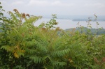
Mount Oka, a Monteregian Hill
Nearer our time, 130 million years ago, movement of the North American plate fractured the continental crust. Molten rock then filtered into the fissures and deformed the surface layer without breaking through. This formed what are called the Monteregian Hills of the Saint Lawrence Valley, including Mount Oka. To the northeast of recently formed Mount Oka is the very old relief of Masson and Calvaire Hills.
Melting of the icecap covering North America 18,000 years ago led to the present appearance of the landscape. The retreating glaciers uncovered the hills by carrying away the sediment around them. In the case of Mount Oka, scraping by the glaciers carried away the very hard rock that covered the magma intrusion. This intrusive rock, which was less hard, eroded faster, leaving the base of Mount Oka.
Mount Oka has the shape of a plateau slightly inclined toward Lac des Deux Montagnes. On this plateau can be seen the la Trappe, Sainte-Sophie and Grande Baie Monteregian hills. The Grande Baie hills occupy the eastern part of Parc national d’Oka. The geological formation of Mount Oka represents about 35% of the Oka hills(NOTE 10). With the Saint-André-Est intrusion, Mount Oka is thought to have been the first Monteregian hill formed, about 17 million years before Mount Megantic, the last one to appear(NOTE 11).
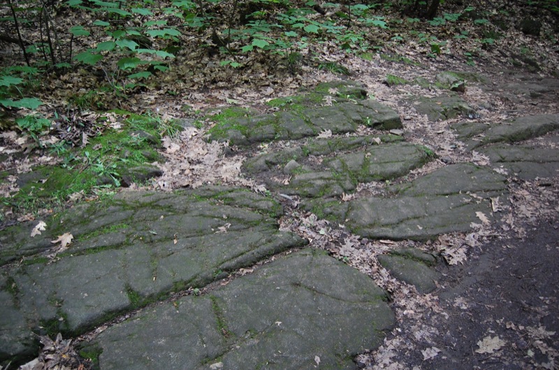
Traces of the last glacial period
Many signs of the passage of glaciers can be seen in Parc national d’Oka. The melting icepack released a mixture of debris, ranging from very fine clays to rocks of almost a metre across. This glacial till, unsuitable for agriculture, was covered by forest, and can still be seen along the hill road. There are also some erratic rocks as large as three metres in diameter. These rocks, transported long distances by the glacier, lie not on the bedrock but on loose soil. The glaciers’ passage also gave the surrounding hills their rounded form. The Champlain Sea, formed by the melted icepack, covered the region for several thousand years. The deposits of silt and clay that it left as it withdrew are now some of Quebec’s most fertile lands.
The beach at Parc national d’Oka is the most
spectacular trace from the end of the glacial era. This immense sand bank,
almost eight kilometres long, was created by great quantities of sand that the
Ottawa River deposited in Lac des Deux Montagnes. During the 1950s, three
cement plants were pumping this sand from the bottom of the lake.
Traces of human habitation from 4,500 years ago
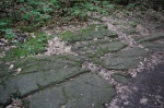
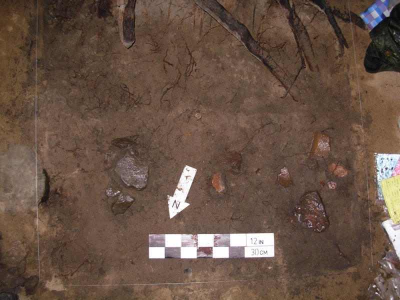
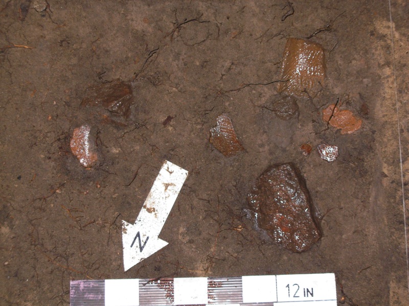
Prehistoric traces have been found in the beach area. This beach, a strategic site and the largest beach of Lac des Deux Montagnes, is located at the confluence of the Saint Lawrence and the Ottawa rivers. The area is overlooked by Calvaire Hill, an important landmark for travellers. From 4,500 to 1,500 years ago, nomadic peoples lived at the site intermittently, especially during the summer for fishing. The artifacts found there indicate a more regular presence between 2,500 and 1,500 years ago(NOTE 12). Fishing was done at the mouth of Rivière aux Serpents. The rope for trawl lines and nets was made from basswood bark and from the stems of plants found in the park. The main fish caught were sturgeon, pike, maskinonge and pickerel. Pickerel, or “oka” in the Algonquin language, is abundant in the lake and is still associated with the region. While fishing was the main occupation of the Amerindians camped at Oka, hunting small game and birds supplemented their diet.
As well as making pottery on site, the Amerindians gathered mussels, which were numerous on the lakeshore. With the area’s diverse flora, they could also gather various wild fruits, some medicinal plants, and vegetable fibres for making baskets and dyes.
For reasons that are not understood, the Oka site was almost deserted by the Amerindians 1,500 years ago. This coincided with the introduction of corn growing in the Saint Lawrence Valley(NOTE 13). At that time, the gradual warming of the North American climate made it possible to grow crops and to hunt further north. The nomadic hunters were able to move further north without much difficulty, while corn growers gradually occupied the Saint Lawrence Lowlands. Until the founding of the Lac des Deux Montagnes mission in 1721, the Oka site was no longer occupied regularly. The Lac des Deux Montagnes mission became, among other things, an important fur trading post in the 18th century. It is not well known that the mission was first located at the mouth of Rivière aux Serpents, at the western edge of the park. A bicycle path crossing the park at this spot gives access to the main heritage sites of the old seigneurie of Lac des Deux Montagnes.
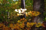
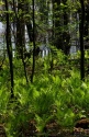
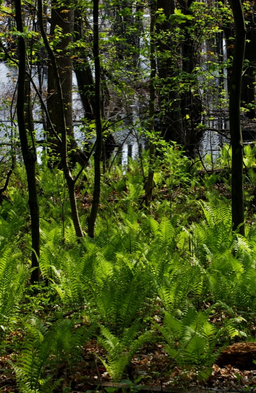
A refuge for Laurentian flora

Among the park’s rare plants are also three plants believed to have been introduced by Amerindians for medicinal purposes: mayapple (podophyllum peltatum), spotted wintergreen or striped prince’s pine (chimaphilia maculata), and yellow pimpernel (taenidia integerrima)(NOTE 15). Although present in southern Ontario and the eastern United States, they are very rare elsewhere in Quebec.
In 2005 the floral habitat of the Hêtraie-du-Calvaire-d'Oka was designated by the government of Quebec as an important environment for conservation of particular species. Two of the eight exceptional forest ecosystems of Parc national d'Oka are on Calvaire Hill: a wet cedar grove, and a beech consisting partly of red oaks and sugar maples.
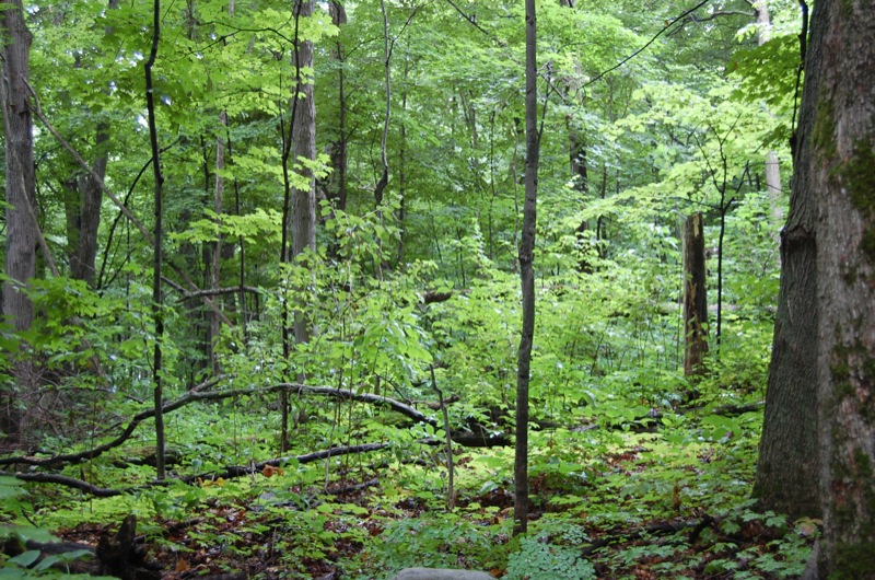
Biodiversity and multiple ecosystems (NOTE 16)
In addition to Calvaire Hill, the park contains several different ecosystems, for example the wetlands of Grande Baie and Rivière aux Serpents, the shore line of Lac des Deux Montagnes, and terrestrial environments that are natural or marked by the human activity of the hill road.
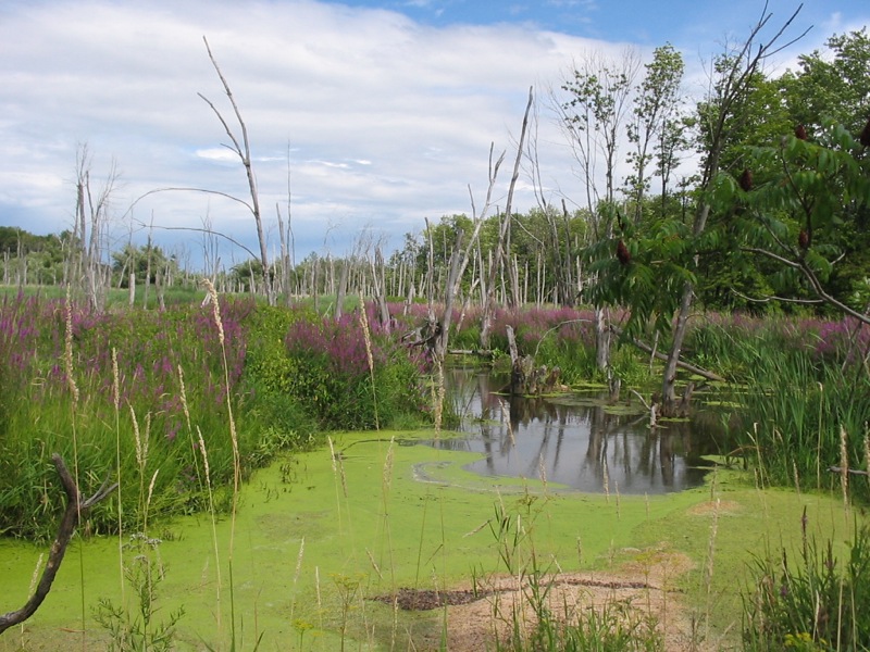
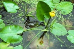
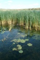
Wetlands of Grande Baie and of Rivière aux Serpents
The ecological importance of marshes is now recognized. They are habitats for many animals, and provide areas for protection, reproduction and feeding necessary for their survival. In addition to protecting the banks from erosion and reducing the impact of spring flooding, their flora contributes to water purification. In 2001 it was estimated that 90% of wetlands had disappeared from southwest Quebec, making it important to preserve these zones in Parc national d'Oka.
The Northern water snake, the most aquatic of Quebec’s grass snakes, is common there(NOTE 17). The park’s only carnivorous plant, common bladderwort (utricularia vulgaris) is found there, as well as wild rice, which was formerly harvested by the Amerindians. At the edge of the marshes, stands of silver maples and the associated vegetation that they favour provide habitat for the wood duck, a species that was endangered in the early 1900s. Thanks to a program to reestablish its population and to an environment suitable for nesting, the wood duck is now well established in the park(NOTE 18). The Great Blue Heron, which nests in trees, finds the ideal nesting spot in this environment. The Grande Baie heronry is among the most important in the Laurentians(NOTE 19). In addition, at least three of Quebec’s nine species of turtles are found in Parc national d’Oka. The Wood Turtle and the Map Turtle, both rare, are considered vulnerable species(NOTE 20). One of the most common, the Snapping Turtle, can have a shell as long as a half metre(NOTE 21).
The
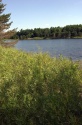
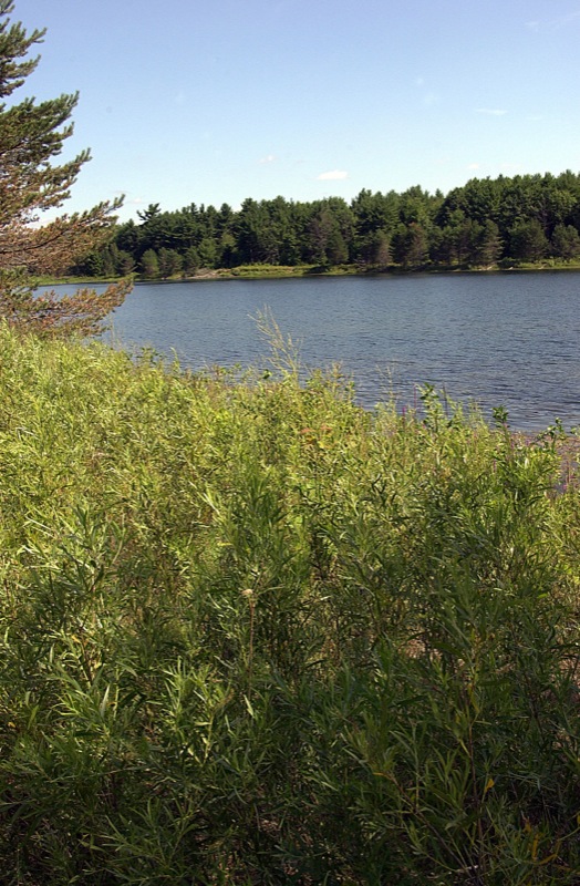
shoreline of Lac des Deux Montagnes
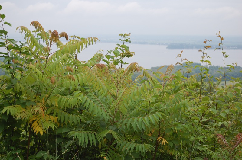
Parc national d’Oka is known for its huge white-sand beach bordering Lac des
Deux Montagnes(NOTE 22). The sandy soil and the width of
the shore favour the growth of woody species that used to be abundant in this
region. They include the white oak, an endangered giant that can live for
centuries, and the white pine, a species that intensive exploitation has almost
wiped out in Outaouais (NOTE 23). Bordering this zone is a mature
forest of red oak (Quercus rubra), basswood or American linden (Tilia americana),
white ash (Fraxinus americana), red maple (Acer rubrum and
slippery elm (Ulmus rubra). The swamp white oak (Quercus bicolor), a rare
species, can also be admired there.
Since the end of commercial fishing and of discharges by paper mills into the river and lake, fish populations have been relatively stable. They include lake sturgeon, northern pike, walleye, brown bullhead, catfish, yellow perch, and shad.
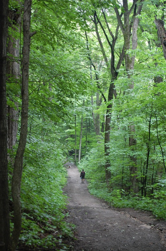
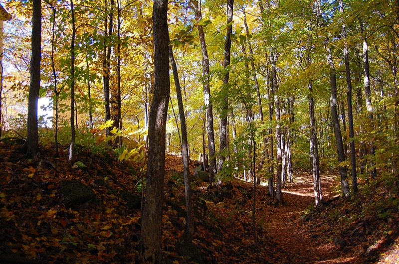
Environment of the Chemin des Collines (Hill Road)
The region’s fertile lands have been cultivated since the 18th century. The very rich soil found at Oka and at Saint-Hyacinthe gives these two regions the greatest agricultural potential in Quebec. Within the park territory there is still, at the foot of Calvaire Hill, a farm producing barley and forage plants. Two sugar maple groves in addition to the one on Calvaire Hill are found along the Chemin des Collines. A few apple trees remaining from old orchards still stand here and there.
Some lands that were formerly cultivated now lie fallow. They form transition zones between field and forest, supporting quite varied flora and fauna. Common milkweed, a plant that feeds monarch butterflies, is found there. The great diversity of environments in the park attracts birds of more than 200 species. It supports populations such as that of the eastern bluebird, a species that was in decline during the 1990s (NOTE 24).
Scientific study and monitoring of ecosystems

Parc national d’Oka carries out more than twenty
scientific research projects each year, some of them jointly with universities,
research centres, and specialized companies. The subjects studied involve areas
as diverse as plant biology, geology, ornithology, entomology, and forestry.
As well as contributing to conservation of one
of the most representative sites of Quebec’s natural heritage, Parc national
d’Oka aims to strengthen its educational mission, particularly its involvement
with educational institutions and cultural tourism organizations. The
preservation and enhancement of Calvaire Hill is an eloquent example of this
activity(NOTE 25).
Gilles Piédalue
Historian, Parc national d'Oka
NOTES
1. Parc national d’Oka, Service de la conservation et de l’éducation, Synthèse des connaissances, Parc national d’Oka, 2008, pages 11, 103-104.
2. It was ceded to the Compagnie Immobilière 1936. Founded in 1935 under the name Compagnie Immobilière Belgo-Canadienne by Baron Louis Empain, the company planned to invest in Canada before the Second World War broke out. “The memorable session is over. Bill 33 has failed and the Sulpicians cede the domain of Oka – 3,700 acres of cultivated land and 1,600 acres of forest – to Baron Louis Empain, who attracts and settles Belgian settlers.” But this company gave up its real estate projects in Quebec in 1945. Rumilly, Robert, Histoire de la Province de Québec, Éditions Valiquette, Montréal, 1940-, v.35, p.185.
3. The Sulpicians had planned to build there since the 1930s, but they gave up the plan in 1957 because the municipality of Oka intended to impose a property tax. The railroad that was to bring future residents from the Deux-Montagnes station was also not built. The Sulpicians did continue to rent out hunting stations to prominent people in the Grande-Baie d’Oka area.
4. The Loi sur les parcs prohibits any form of hunting, prospecting, use and development of resources for purposes of forestry, mining or energy production, as well as pipelines and energy transport lines.
5. The Parc national d’Oka owes its status as a national park to the fact that it contains a representative sample of the biological and geomorphological systems of one of the great natural regions of Quebec, the Saint Lawrence Basses-Terres region, particularly its southern part.
6. Ste-Croix, Lucie, Géologie des environs d’Oka, Parc Paul-Sauvé, Oka, 1985, 67 pages.
7. In 1990, its status was that of Parc de récréation d’Oka. Declared a Quebec national park in 2001 and managed since then by the Société des établissements de plein air du Québec (Sépaq), it now bears the name of Parc national d’Oka.
8. Oka Precambrian hills: Calvaire Hill, Masson Hill, Sommet Hill, Radar Mountain, Mont Bleu or Saint-Alexis, Twin mountain of Saint-Joseph du Lac.
9. Landry, Bruno and Mercier, Michel, Notions de géologie, Modulo Éditeur, 3rd edition, 1992, Mont-Royal, Québec, p. 530.
10. Hills of the Grande Baie area: colline de l’Est, butte du secteur Le Portage, butte du secteur Le Coq Rond. Gold, D.P., Bedrock Geological Map of the Oka Complex, 1961.
11. Parc national d’Oka, Service de la conservation et de l’éducation, Synthèse des connaissances, Parc national d’Oka, 2008, p.110 and p.185.
12. Chapdelaine, Claude, “Un site du Sylvicole moyen ancien sur la plage d’Oka”, Recherches amérindiennes au Québec, Montréal, Québec, 1990, Volume XX, no.1, pp.19-36.
13. Chapdelaine, Claude, “Un site du Sylvicole moyen ancien sur la plage d’Oka”, Recherches amérindiennes au Québec, Montréal, Québec, 1990, Volume XX, no.1, pp.19-36.
14. http://www.mddep.gouv.qc.ca/biodiversite/especes/corallorhize/corallorhize.htm
15. http://www.mddep.gouv.qc.ca/biodiversite/especes/podophylle/podophylle.htm
16. Parc national d’Oka, Service de la conservation et de l’éducation, Synthèse des connaissances, Parc national d’Oka, 2008, pp.13-64.
17. http://www.atlasamphibiensreptiles.qc.ca/index.php?option=com_content&view=article&id=38&Itemid=48
18. http://www.ffdp.ca/hww2_F.asp?id=80
19. http://www.ffdp.ca/hww2_f.asp?id=43
20. http://www.atlasamphibiensreptiles.qc.ca/index.php?option=com_content&view=article&id=30&Itemid=39, http://www.atlasamphibiensreptiles.qc.ca/index.php?option=com_content&view=article&id=32&Itemid=41
21. http://www.atlasamphibiensreptiles.qc.ca/index.php?option=com_content&view=article&id=27&Itemid=36
22. This beach can receive as many as 10,000 visitors per day in summer. For a summary of leisure activities and accommodation, see:
http://www.sepaq.com/pq/oka/index.dot
23. http://www.mddep.gouv.qc.ca/biodiversite/reserves/iles_avelle-wight/res_49.htm, http://www.mddep.gouv.qc.ca/biodiversite/reserves/irenee_marie/res_13.htm
24. http://fr.wikipedia.org/wiki/Merlebleu_de_l'Est
25. http://www.ameriquefrancaise.org/fr/article-474/Colline%20du%20Calvaire%20d’Oka
BIBLIOGRAPHY
Bourque, Pierre André, Département de géologie et de génie géologique, Université Laval, Le Québec géologique, site web sur les différents aspects de la géologie du Québec, section 5.4 les collines montérégiennes du Crétacé, pp.1-2.
Chapdelaine, Claude, « Un site du Sylvicole moyen ancien sur la plage d'Oka », Recherches amérindiennes au Québec, Montréal, Québec, 1990, Volume XX, no.1, pp.19-36.
Landry, Bruno et Mercier, Michel, Notions de géologie, Modulo Éditeur, 3ième édition, 1992, Mont-Royal, Québec, 565 pages.
Gold, D.P., Bedrock Geological Map of the Oka Complex, 1961.
Harris, R. Cole, Atlas historique du Canada, Volume I, Des origines à 1800, Presses de l'Université de Montréal, 1987, 198 pages.
Parc national d'Oka, Service de la conservation et de l'éducation, Synthèse des connaissances, Parc national d'Oka, 2008, 197 pages.
Ste-Croix, Lucie, Géologie des environs d'Oka, Parc Paul-Sauvé, Oka, 1985, 67 pages.
Additional DocumentsSome documents require an additional plugin to be consulted
Images
-
 Érablière, sentier d
u Calvaire -
 Érablière à sucre, co
lline du Calvai... -
 Flore et faune du mar
ais de la Grand... -
 Héronnière de la Gran
de-Baie

-
 Lac de la sauvagine
-
 Lac des Deux-Montagne
s du haut de la... -
 Marais de la Grande-B
aie -
 Roches précambriennes
, sentier du Ca...
-
 Sentier patrimonial,
colline du Cal... -
 Sous-bois près de la
plage -
 Sous-bois, colline du
Calvaire -
 Tessons de poterie am
érindienne
Hyperliens
- Official website of Parc national d'Oka
- Commission de toponymie du Québec. Habitat floristique de la Hêtraie-du-Calvaire-d'Oka
- Département de sciences de la terre et de l'atmosphère, Université du Québec à Montréal, Les collines montérégiennes en 3D, origine du nom, âge des montérégiennes, géomorphologie, géologie.
- Le Québec géologique, site web sur les différents aspects de la géologie du Québec, section 5.4 les collines montérégiennes du Crétacé, pp.1-2.
- Site officiel du Ministère du Développement durable, Environnement et parcs